Devil's Bridge & Antigua's Rugged East Coast
On the far side of the island, past the last resort and down a rough country road, the Atlantic goes to work on the coast. It has drilled a stone arch through a limestone headland and punched blowholes into the rock, and the whole east coast feels a world away from the calm leeward beaches.
Visit Nelson’s Dockyard, Shirley Heights and Devil’s Bridge in one guided drive. Discover Round Island Highlights

Antigua's east coast is the island stripped of its postcard gloss. This is the windward side, where the trade winds and the open Atlantic hit the land head-on, and the result is dramatic: a natural rock bridge carved clean through the cliffs, geyser-like blowholes that fire spray into the air, and long stretches of empty, wave-battered shore. Devil's Bridge is the headline, but the whole coastline here rewards anyone willing to leave the beach umbrellas behind.
Booking Choice: Visit Nelson’s Dockyard, Shirley Heights and Devil’s Bridge in one guided drive. Check Dates: Round Island Highlights
The short version: Devil's Bridge is a natural limestone arch at Indian Town Point, a national park on Antigua's north-east coast, carved by thousands of years of Atlantic swell and ringed by blowholes. It is free to visit, dramatic, and genuinely slippery, so stay well back from the edge. The wider east coast holds the calm snorkel lagoon of Long Bay, the crescent of Half Moon Bay, and the historic sugar estate of Betty's Hope.
Antigua's east coast, north to south
The windward coast's main sights, from the arch at Indian Town Point down to the offshore islet. Blue marks the calm swim; orange marks the wild Atlantic side.
What Is Devil's Bridge In Antigua?
Devil's Bridge is a natural rock arch on Antigua's rugged north-east coast, formed where the open Atlantic has eroded a span of soft limestone into a bridge over the sea. It sits within a small national park at Indian Town Point, surrounded by blowholes that spout spray as the swell surges through the rock. There is no ticket and no railing, just raw coastline, which is exactly its appeal.
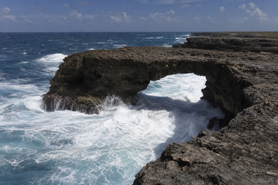
The arch itself is the product of relentless water. This corner of the island takes the full force of the Atlantic, and over thousands of years the waves have exploited a weakness in the limestone shelf, hollowing out a channel and leaving a natural bridge of harder rock standing over it. Stand on the headland and you watch the same process still running: every big roller drives into the gap and bursts back out as spray.
Around the bridge, the rock is pocked with blowholes and small geysers. When a wave surges into a submerged fissure, the water has nowhere to go but up, and it jets out of the stone with a boom and a plume of white. On a day with a strong swell it is genuinely theatrical. On a calm day it is quieter, more a place to scramble the headland and take in the wildness than to watch fireworks, which is worth knowing before you build a whole trip around it.
| Feature | What it is | Good to know |
|---|---|---|
| The arch | Natural limestone bridge over an eroded channel | Do not walk across it; the rock is undercut |
| Blowholes | Fissures that spout spray on the swell | Best show on a big-swell day |
| Indian Town Point | The headland and national park it sits on | Open coast, no facilities, free to visit |
| The setting | Exposed Atlantic (windward) shoreline | Windy, wave-battered, dramatic |
What Is Devil's Bridge National Park At Indian Town Point?
Devil's Bridge sits inside a small national park on Indian Town Point, the headland jutting into the Atlantic on Antigua's north-east corner. The park protects the arch, the blowholes and the scrubby coast around them, all of it open and free to walk. The sea, not any builder, shaped every bit of it.
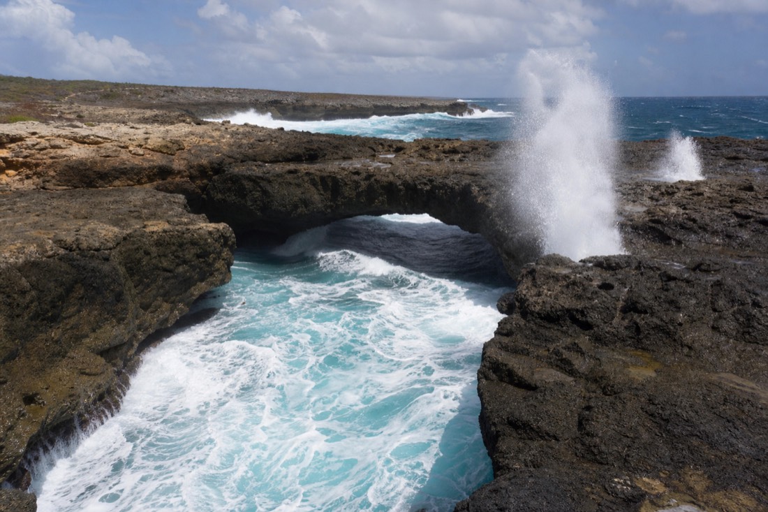
Indian Town Point is the name of the whole promontory, and the arch is its centrepiece. The ground here is a shelf of limestone, a soft, layered rock that began as compacted marine sediment before it lifted above the waterline. Antigua's north-east faces open ocean for thousands of miles, so this shelf catches swell that has built the whole way across the Atlantic, and limestone is exactly the kind of rock that swell can carve.
The arch is what happens when that carving finds a weakness. Waves drive into a joint or a softer band in the rock, widen it into a notch, then a cave, and given enough centuries they cut a cave clean through the headland, leaving a bridge of harder stone spanning the gap. The blowholes work the same way on a smaller scale: where the sea has hollowed a channel with only a narrow opening at the top, each surge forces water and air up through the hole in a spout. It is a live process, not a finished monument, and that is a large part of why the point is protected.
| Stage | What the sea does | What you see today |
|---|---|---|
| 1. Weakness | Swell attacks a joint or soft band in the limestone shelf | The cracked, layered rock of the headland |
| 2. Notch and cave | Repeated waves widen the gap into a hollow, then a cave | Blowholes venting spray through narrow openings |
| 3. Arch | The cave is cut right through the headland | Devil's Bridge itself, spanning the eroded channel |
| 4. Collapse, eventually | The span is undercut until it can no longer hold | Why you never walk out onto the arch |
How Was Devil's Bridge Formed, And Is It Safe To Walk?
Devil's Bridge was carved by wave erosion, as centuries of Atlantic breakers wore a channel through the limestone and left a harder arch spanning it. It is safe to visit but not to treat casually: the rock is slick with spray, the blowholes surge without warning, and rogue waves can sweep the lower shelf. Keep well back from the edge, stay behind any safety markers, and never climb onto the arch itself.
The geology is simple and ongoing. Limestone is soft enough for the sea to sculpt but hard enough to hold a shape, so the coast here is a work in progress: what is a bridge today began as a crack and will eventually collapse into the next feature. That same softness is why the surface underfoot is uneven, sharp in places, and often wet, which is the real hazard. Wet limestone by crashing surf is exactly the kind of ground that looks fine until a foot slides.
Our guides are blunt about this stop for a reason. The danger is not the arch as a photo backdrop, it is the temptation to get closer to the action, out onto the lower rocks where the spray is highest and a bigger-than-average wave can knock you off balance. Watch the sea for a few minutes before you commit to where you stand, keep children and phones firmly in hand, and treat the sea spray and the blowholes as the warning they are. Enjoyed from a sensible distance, it is one of the island's most memorable sights.
The blowholes deserve singling out. They look like a harmless novelty between waves, and then a big set arrives and one fires a column of spray without warning, sometimes from a hole you were standing beside. The ground around them is undercut and slick with runoff, the salt keeps the limestone greasy, and a larger set can wash right across the low shelf where people creep out for a photo. Give the holes a wide berth, never stand on the seaward side of one, and treat every lull as temporary. This is the single spot on the headland where visitors get into trouble, and it is entirely avoidable.
| Do | Don't |
|---|---|
| Watch the sea for a minute before choosing where to stand | Walk out onto the arch itself; it is undercut |
| Stay well back from the edge and behind any markers | Turn your back on the water on the lower shelf |
| Keep children and phones firmly in hand | Chase the biggest spray for a closer photo |
| Wear grippy, closed shoes on the wet rock | Assume a calm moment means the next wave is small |
The Solemn History Of Devil's Bridge
Devil's Bridge carries a heavy history alongside its natural drama. The site is associated with the era of slavery on Antigua, and that association is why the place is treated with real respect by islanders and guides. It is protected national parkland today, valued both as a geological landmark and as a place of memory, so it is worth arriving with an understanding that this is more than a scenic photo stop.
The name and the site sit within Antigua's difficult colonial past, and local guides handle it with care rather than sensationalism. We follow their lead here: the respectful thing is to acknowledge that this coastline holds a solemn history connected to enslaved people on the island, without dressing it up in invented detail. If you visit with a guide, you will usually hear that context on the headland, delivered plainly.
Holding both truths at once is part of what makes the east coast affecting. The same limestone that draws visitors for its arch and its blowholes is bound up with the island's history of sugar and slavery, a history you also meet a short drive away at the ruined estates inland. Approaching Devil's Bridge as a place of memory as well as a natural wonder is simply the honest way to see it.
Where Is Devil's Bridge And How Do You Get There?
Devil's Bridge is on the north-east coast at Indian Town Point, near the village of Willikies, roughly at the opposite end of the island from St. John's and the resort strip. You reach it by rental car, taxi or a guided tour, following the road east past the airport and out toward the coast. The final stretch runs on rough country roads, so allow extra time and drive gently.
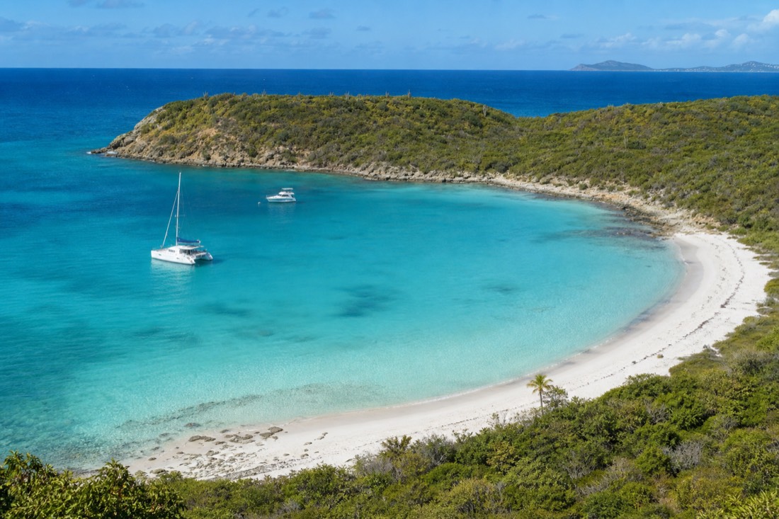
Getting there is half the character of the trip. The route crosses from the developed west and north into the quieter, more rural east, past cane-country villages and open scrub, and the tarmac gets patchier the closer you get to the coast. A regular car manages it fine if you take the bumps slowly, but this is not a five-minute hop from the beach; budget for a proper drive each way and you will not feel rushed at the top.
Antigua and Barbuda's official tourism board lists Devil's Bridge among the island's must-see natural landmarks, which is a fair reflection of how popular the stop is despite the drive. A guided tour solves the navigation and the driving in one go, and it usually folds Devil's Bridge into a bigger east-side loop so the long drive earns you several stops rather than one. If you are self-driving, pair it with the other east-coast sights below so the journey is worth it. Either way, there are no shops or cafes at the bridge itself, so carry water, sun cover and anything else you will want, because the headland is exposed and there is nothing to buy once you are out there.
| Way there | How it works | Best for |
|---|---|---|
| Rental car | Drive east past the airport toward Willikies | Combining several east-coast stops at your pace |
| Taxi | Agree a round trip with waiting time | No driving on the rough final roads |
| Guided island tour | Devil's Bridge as one stop on a loop | History, logistics and multiple sights handled |
What Else Is On Antigua's Rugged East Coast?
The east coast strings together several of the island's wildest sights. Beyond Devil's Bridge and Indian Town Point, there is the calm snorkel lagoon of Long Bay, the dramatic crescent of Half Moon Bay, the uninhabited islet of Green Island offshore, and inland the ruined sugar estate of Betty's Hope. It is the quiet, undeveloped end of Antigua, and a single day can take in a surprising amount of it.
What ties these places together is exposure. This is the windward side, so the beaches run from lively to genuinely rough, and the coastline is scalloped into headlands and bays that each catch the Atlantic differently. Long Bay is the gentle exception, tucked behind an inner reef that flattens the swell; Half Moon Bay is the showpiece crescent, beautiful but with real surf in its middle; and Green Island, just offshore, is a roadless beach stop reached only by boat.
Inland, the story shifts from geology to heritage. Betty's Hope is a restored sugar plantation dating back to 1651, where you can walk among weathered masonry and see a fully restored stone mill tower complete with its working sails. It is one of the clearest windows into the industry that shaped the island, and it sits close enough to the coast to pair with a Devil's Bridge morning. For where these east-coast beaches fit in the island's wider lineup, our guide to the best beaches in Antigua ranks them by coast and conditions.
| East-coast sight | What it is | Access |
|---|---|---|
| Devil's Bridge / Indian Town Point | Natural rock arch and blowholes | Drive or tour, free, exposed headland |
| Long Bay | Calm reef-sheltered swimming and snorkel lagoon | Drive or tour, roadside beach |
| Half Moon Bay | Crescent beach, Atlantic surf, national park | Longer drive, few services |
| Green Island | Uninhabited offshore islet, beach stop | Boat only, on full-island trips |
| Betty's Hope | Historic 1651 sugar estate, restored mill | Drive or tour, open-air heritage site |
A Worked Half-Day On Antigua's East Coast
Devil's Bridge on its own is a short stop, so the east coast rewards you most as a half-day loop. A rough plan from St. John's: Betty's Hope on the way out, then the arch and blowholes, then a swim and snorkel at Long Bay before the drive back. Allow four to five hours including the driving.
The logic of the route is to string the inland heritage and the wild coast together so the long drive earns its keep. Betty's Hope sits on the way out, which makes it the natural first stop while the morning is still cool. Devil's Bridge is the dramatic middle, and Long Bay, only a short hop further, is the calm reward at the end: a place to rinse off the salt spray and get in the water before turning for home.
The times below are planning allowances, not a fixed schedule, and they flex with how long you linger and how the roads are running. If you would rather add the crescent of Half Moon Bay, budget a longer day and more driving on rough roads at the far end. Carry water and snacks either way, because there is nothing to buy once you leave the main road. If the driving and the rough roads put you off, a guided day tour of the island can fold this whole loop in and drop you back at your hotel.
| When (allow) | Stop | What you do |
|---|---|---|
| Start | Leave St. John's | Drive east past the airport toward Willikies |
| On the way | Betty's Hope | Walk the restored 1651 sugar mill and estate ruins |
| Late morning | Devil's Bridge / Indian Town Point | The arch and blowholes; watch the sea, stay back from the edge |
| Midday | Long Bay | Calm swim and snorkel off the sand behind the inner reef |
| Early afternoon | Return | Drive back to St. John's or the resort strip |
Why Is The East Coast So Wild?
The east coast is wild because it is the windward side of the island, facing the open Atlantic with nothing to shelter it. The trade winds blow from the east almost year-round, driving swell straight onto the shore, so the water is rougher, the wind is stronger, and seasonal sargassum seaweed can pile up on the tideline. The leeward west and north coasts, by contrast, sit calm in the island's lee.
This one fact explains the whole feel of the coast. Because the wind and waves arrive here first, the east takes the energy that the sheltered beaches never see, which is why the sand is emptier, the surf is bigger and the cliffs are more sculpted. It also means conditions change fast: a benign morning can turn choppy as the wind builds, and currents on the exposed beaches run stronger than anywhere on the calm side. If you plan to swim, the windward coast asks for more caution than the leeward.
Seasonal sargassum is the other windward reality. At times of year the Atlantic carries mats of this brown seaweed onto east-facing beaches, where it collects on the tideline. It is natural and harmless, but it can dull the look of an otherwise gorgeous beach on the wrong week, which is one more reason to check conditions before a long drive east. For a sense of when the sea is calmest and the sargassum least likely, see our guide to the best time to visit Antigua.
The Best Beaches Near Devil's Bridge
The standout swimming beach near Devil's Bridge is Long Bay, where an inner reef shelters a calm, shallow lagoon that is safe for easy swimming and good for snorkeling straight off the sand. Half Moon Bay, further south, is the more dramatic option: a beautiful crescent with real Atlantic surf in the middle and a calmer, swimmable corner at one end. They are the windward coast's two best beach days.
Long Bay is the one to head for if you want to get in the water without a fight. Despite sitting on the wild side of the island, it is protected by a reef close to shore, so the waves break out on the coral and leave a clear, calm shelf inside. You can wade in from the sand and find colourful fish over the shallow reef, which makes it a rare thing on this coast: an easy, family-friendly swim. Our operators use exactly this beach as the calm-water counterpoint to a bracing Devil's Bridge stop.
Half Moon Bay asks for more judgement. Protected as a national park and often near the top of the island's prettiest-beach lists, it curves in a long pale arc that catches the Atlantic swell full in the centre, so the middle is for bodysurfing more than gentle floating. Head for the sheltered northern end if you want to swim in peace. For the full picture of where to get in the water across the island, our guide to snorkeling in Antigua covers the reefs and the calm spots worth the drive.
| Beach | Conditions | Swimming | Note |
|---|---|---|---|
| Long Bay | Sheltered by an inner reef | Calm, easy, family-friendly | Snorkel straight off the sand |
| Half Moon Bay | Atlantic surf, calmer at the north end | Surf in the middle, gentle corner | National park, few services |
| Green Island | Reef-ringed, offshore | Calm, boat access only | Uninhabited lunch-stop islet |
Betty's Hope And The Sugar-Estate History Nearby
Betty's Hope is a restored sugar plantation near Devil's Bridge, dating back to 1651. It is the easiest place on the island to grasp the sugar-and-slavery economy that shaped Antigua, with a restored stone mill tower and its sails, the foundations of a second mill, and weathered ruins you can walk among in the open air. It pairs naturally with a Devil's Bridge morning.
The estate reads as an open-air museum. You wander among the masonry of a working plantation, and the centrepiece is the restored mill tower, complete with the great sails that once ground the cane. Seeing the machinery in place makes the scale of the industry concrete in a way that a signboard never quite does. As with Devil's Bridge, the history here is sobering: this was a place built on enslaved labour, and the site does not shy from that.
Because it runs under independent heritage-trust oversight, opening can vary and the site occasionally closes at short notice for conservation, so it is worth checking before a special trip. A good guide will fold it into the east-coast loop and, if the buildings are closed, walk you around the outer grounds and the mill foundations instead. Together, the ruined estate inland and the wild coast at the bridge tell two halves of the same island story.
Which Tour Takes You To Devil's Bridge And The East Coast?
The previously linked Salty Dogs UTV product is marked inactive in Viator’s current API. Do not treat it as a confirmed departure. For a self-drive experience on this shortlist, Reef Riders operates two-seat boats to Cades Reef, subject to its driver-age, passenger-age and combined-weight limits.
If Devil's Bridge is the sight you specifically want, the small-group tour is the most complete way to do it. Our operators run a small-group island tour with a stingray encounter that gives Devil's Bridge a proper 20-minute stop, then crosses to the calm inner reef at Long Bay for snorkeling, serves a home-cooked lunch in the coastal village of Seatons, and finishes at the 1651 sugar estate of Betty's Hope. The 3.5-hour round-island adventure also stops at the bridge on its way between the interior and the historic south.
The previously linked Salty Dogs UTV product is marked inactive in Viator’s current API. Do not treat it as a confirmed departure. For a self-drive experience on this shortlist, Reef Riders operates two-seat boats to Cades Reef, subject to its driver-age, passenger-age and combined-weight limits.
| Tour | Platform | Reaches Devil's Bridge? | What it's really for |
|---|---|---|---|
| Small-group tour with stingray encounter | Viator | Yes, a 20-minute stop | Devil's Bridge, Long Bay snorkel, Betty's Hope |
| Round-island adventure | Viator | Yes, a short stop | Full-island highlights loop |
| Salty Dogs UTV with beach stop | Viator | No, backcountry and southwest | Rugged off-road adventure and a swim |